 |
This is a file from the Wikimedia Commons. Information from its description page there is shown below.
Commons is a freely licensed media file repository. You can help.
|
Summary
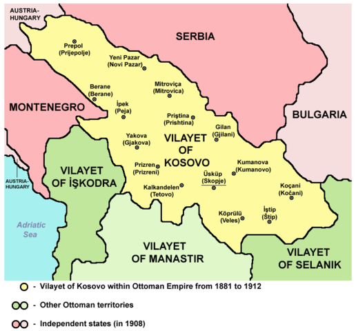
Vilayet of Kosovo within Ottoman Empire from 1881 to 1912
Source and licence
| Public domainPublic domainfalsefalse |
 |
This map has been uploaded by Electionworld from en.wikipedia.org to enable the  Wikimedia Atlas of the World Wikimedia Atlas of the World  . Original uploader to en.wikipedia.org was PANONIAN, known as PANONIAN at en.wikipedia.org. Electionworld is not the creator of this map. Licensing information is below. . Original uploader to en.wikipedia.org was PANONIAN, known as PANONIAN at en.wikipedia.org. Electionworld is not the creator of this map. Licensing information is below. |
| Public domainPublic domainfalsefalse |
 |
This work has been released into the public domain by its author, PANONIAN. This applies worldwide.
In some countries this may not be legally possible; if so:
PANONIAN grants anyone the right to use this work for any purpose, without any conditions, unless such conditions are required by law.Public domainPublic domainfalsefalse
|
References
Main reference:
- Created according to historical map from this book: Petrit Imami, Srbi i Albanci kroz vekove, Beograd, 2000.
Secondary references with similar maps:
- Noel Malcolm, Kosovo - A Short History, Pan Books, London, 2002.
- Školski istorijski atlas, Zavod za izdavanje udžbenika SR Srbije, Beograd, 1970.
- Sve srpske mape - od šestog veka do Pariza, Specijalno izdanje BLICA, Decembar 1995. godine.
File usage
The following pages on Schools Wikipedia link to this image (list may be incomplete):
Through Schools Wikipedia, SOS Children's Villages has brought learning to children around the world. SOS Children's Villages helps more than 2 million people across 133 countries around the world. Would you like to sponsor a child?


