 |
This is a file from the Wikimedia Commons. Information from its description page there is shown below.
Commons is a freely licensed media file repository. You can help.
|
| Description |
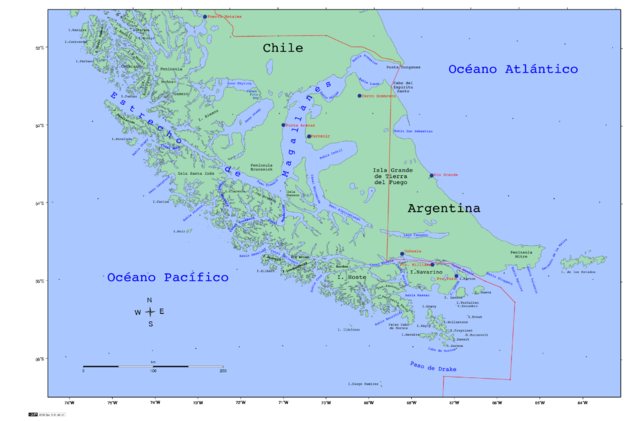
Strait of Magellan, Chile |
| Date |
2008 |
| Source |
Own work |
| Author |
Createaccount |
Permission
( Reusing this file) |
 |
The map has been created with the Generic Mapping Tools: http://gmt.soest.hawaii.edu/ using one or more of these public domain datasets for the relief:
- ETOPO2 ( topography/ bathymetry): http://www.ngdc.noaa.gov/mgg/global/global.html
- GLOBE ( topography): http://www.ngdc.noaa.gov/mgg/topo/gltiles.html
- SRTM ( topography): http://www2.jpl.nasa.gov/srtm/
|
 |
Permission is granted to copy, distribute and/or modify this document under the terms of the GNU Free Documentation License, Version 1.2 or any later version published by the Free Software Foundation; with no Invariant Sections, no Front-Cover Texts, and no Back-Cover Texts. A copy of the license is included in the section entitled GNU Free Documentation License. http://www.gnu.org/copyleft/fdl.htmlGFDLGNU Free Documentation Licensetruetrue
|
|
This file contains additional information, probably added from the digital camera or scanner used to create or digitize it. If the file has been modified from its original state, some details may not fully reflect the modified file.


