 |
This is a file from the Wikimedia Commons. Information from its description page there is shown below.
Commons is a freely licensed media file repository. You can help.
|
Summary
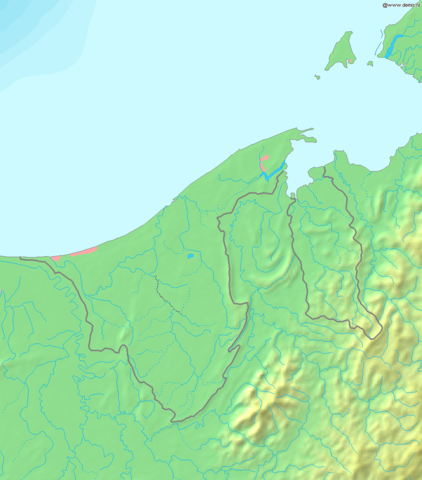
| DescriptionMap of Brunei Demis.png |
Deutsch: Topografische Karte von Brunei. Quadratische Plattkarte, Zentrum: 4°39′00″N 114°45′00″E / 4.65000°N 114.75000°E / 4.65000; 114.75000. Geographische Begrenzung der Karte:
- N: 5.5° N
- S: 3.8° N
- W: 114° O
- O: 115.5° O
English: Blank relief map of Brunei. Equirectangular projection centered at 4°39′00″N 114°45′00″E / 4.65000°N 114.75000°E / 4.65000; 114.75000. Geographic limits of the map:
- N: 5.5° N
- S: 3.8° N
- W: 114° E
- E: 115.5° E
Français : Carte du relief vierge du Brunei. Projection équirectangulaire centrée en 4°39′00″N 114°45′00″E / 4.65000°N 114.75000°E / 4.65000; 114.75000. Limites géographiques de la carte :
- N: 5.5° N
- S: 3.8° N
- O: 114° E
- E: 115.5° E
|
| Date |
20 December 2006 |
| Source |
Own work, using Demis data |
| Author |
Mats Halldin ( talk) |
Licensing
| Public domainPublic domainfalsefalse |
 |
This image is in the public domain because it came from the site http://www.demis.nl/home/pages/Gallery/examples.htm and was released by the copyright holder. Permission is granted to copy, distribute and/or modify this map since it is based on free of copyright images from: www.demis.nl. See also approval email on de.wp and its clarification.
|
File usage
The following pages on Schools Wikipedia link to this image (list may be incomplete):
This file contains additional information, probably added from the digital camera or scanner used to create or digitize it. If the file has been modified from its original state, some details may not fully reflect the modified file.


