 |
This is a file from the Wikimedia Commons. Information from its description page there is shown below.
Commons is a freely licensed media file repository. You can help.
|
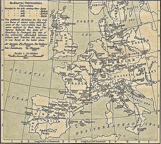
| DescriptionMap of Medieval Universities.jpg |
Deutsch: Karte der mittelalterlichen Universitäten
English: Map of medieval universities
|
| Date |
1923 |
| Source |
William R. Shepherd: Historical Atlas, New York, Henry Holt and Company, 1923, in the Public Domain (also to be found in the 1911 edition, p. 100) |
| Author |
This file is lacking author information.
|
| Public domainPublic domainfalsefalse |
 |
This image (or other media file) is in the public domain because its copyright has expired.
This applies to Australia, the European Union and those countries with a copyright term of life of the author plus 70 years.
 You must also include a United States public domain tag to indicate why this work is in the public domain in the United States. Note that a few countries have copyright terms longer than 70 years: Mexico has 100 years, Colombia has 80 years, and Guatemala and Samoa have 75 years, Russia has 74 years for some authors. This image may not be in the public domain in these countries, which moreover do not implement the rule of the shorter term. Côte d'Ivoire has a general copyright term of 99 years and Honduras has 75 years, but they do implement the rule of the shorter term. You must also include a United States public domain tag to indicate why this work is in the public domain in the United States. Note that a few countries have copyright terms longer than 70 years: Mexico has 100 years, Colombia has 80 years, and Guatemala and Samoa have 75 years, Russia has 74 years for some authors. This image may not be in the public domain in these countries, which moreover do not implement the rule of the shorter term. Côte d'Ivoire has a general copyright term of 99 years and Honduras has 75 years, but they do implement the rule of the shorter term.
|
|
This file has been identified as being free of known restrictions under copyright law, including all related and neighboring rights.
|
File usage
The following pages on Schools Wikipedia link to this image (list may be incomplete):
Through Schools Wikipedia, SOS Childrens Villages has brought learning to children around the world. SOS Children's Villages believes that a decent childhood is essential to a happy, healthy. Our community work brings families new opportunities through education, healthcare and all manner of support. Find out how you can help children in other countries.


