 |
This is a file from the Wikimedia Commons. Information from its description page there is shown below.
Commons is a freely licensed media file repository. You can help.
|
| Description |
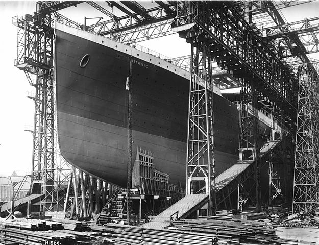
H1560 R.W. English: The RMS Titanic ready for launch. The ship was constructed on Queen's Island, now known as the Titanic Quarter, in Belfast Harbour where was part of the Harland and Wolff shipyard.
Polski: RMS Titanic w czasie budowy.
|
| Date |
1911 |
| Source |
 |
This image is available from the United States Library of Congress's Prints and Photographs division under the digital ID cph.3a27541.
This tag does not indicate the copyright status of the attached work. A normal copyright tag is still required. See Commons:Licensing for more information.
|
|
| Author |
Robert John Welch (1859-1936), official photographer for Harland & Wolff |
Permission
( Reusing this file) |
| Public domainPublic domainfalsefalse |
 |
This image (or other media file) is in the public domain because its copyright has expired.
This applies to Australia, the European Union and those countries with a copyright term of life of the author plus 70 years.
 You must also include a United States public domain tag to indicate why this work is in the public domain in the United States. Note that a few countries have copyright terms longer than 70 years: Mexico has 100 years, Colombia has 80 years, and Guatemala and Samoa have 75 years, Russia has 74 years for some authors. This image may not be in the public domain in these countries, which moreover do not implement the rule of the shorter term. Côte d'Ivoire has a general copyright term of 99 years and Honduras has 75 years, but they do implement the rule of the shorter term. You must also include a United States public domain tag to indicate why this work is in the public domain in the United States. Note that a few countries have copyright terms longer than 70 years: Mexico has 100 years, Colombia has 80 years, and Guatemala and Samoa have 75 years, Russia has 74 years for some authors. This image may not be in the public domain in these countries, which moreover do not implement the rule of the shorter term. Côte d'Ivoire has a general copyright term of 99 years and Honduras has 75 years, but they do implement the rule of the shorter term.
|
|
This file has been identified as being free of known restrictions under copyright law, including all related and neighboring rights.
|
| Public domainPublic domainfalsefalse |
 |
This is a press photograph from the George Grantham Bain collection, which was purchased by the Library of Congress in 1948. According to the library, there are no known restrictions on the use of these photos. |
|
|
Camera location
|
54° 36′ 36.56″ N, 5° 54′ 6.49″ W
|
This and other images at their locations on: Google Maps - Google Earth - OpenStreetMap |
( Info)54.610155555556;-5.9018027777778 |
File usage
The following pages on Schools Wikipedia link to this image (list may be incomplete):
Wikipedia for Schools is one of SOS Children's many educational projects. In 133 nations around the world, SOS Children works to bring better education and healthcare to families in desperate need of support. Find out more about sponsoring a child.


