 |
This is a file from the Wikimedia Commons. Information from its description page there is shown below.
Commons is a freely licensed media file repository. You can help.
|
| DescriptionBritish colonies 1763-76 shepherd1923.PNG |
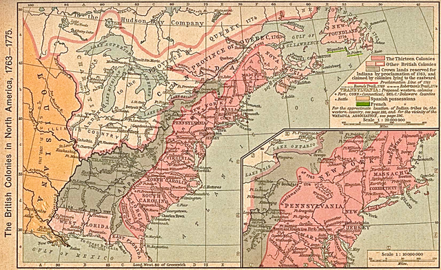
English: Map of the British colonies in North America, 1763 to 1775. This was first published in: Shepherd, William Robert (1911) " The British Colonies in North America, 1763–1765" in Historical Atlas, New York, United States: Henry Holt and Company, pp. p. 194 Retrieved on 27 October 2010.
|
| Date |
circa 1911 (depicting 1763-75 period) |
| Source |
Scan from Historical Atlas by William R. Shepherd, New York, Henry Holt and Company, 1923; the map is unchanged from the 1911 original version.
Original image at the Perry-Castañeda Library Map Collection at the University of Texas at Austin. |
| Author |
William Robert Shepherd (1871–1934)  |
| Description |
American cartographer and historian
|
| Date of birth/death |
12 June 1871 |
7 June 1934 |
| Location of birth/death |
Charleston |
Berlin |
| Work location |
New York City |
| Authority control |
|
|
Permission
( Reusing this file) |
| Public domainPublic domainfalsefalse |
 |
This work is in the public domain in the United States because it was published (or registered with the U.S. Copyright Office) before January 1, 1923. Public domain works must be out of copyright in both the United States and in the source country of the work in order to be hosted on the Commons. If the work is not a U.S. work, the file must have an additional copyright tag indicating the copyright status in the source country.
|
|
File usage
The following pages on Schools Wikipedia link to this image (list may be incomplete):
This file contains additional information, probably added from the digital camera or scanner used to create or digitize it. If the file has been modified from its original state, some details may not fully reflect the modified file.


