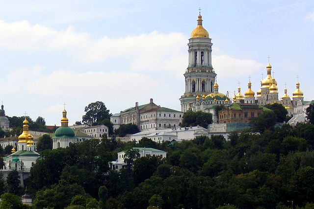
File:2005-08-15 Pechersk Lavra seen from river Dnepr Kiev 311 cropped.jpeg

Size of this preview: 640 × 427 pixels.
| |
This is a file from the Wikimedia Commons. Information from its description page there is shown below.
Commons is a freely licensed media file repository. You can help. |
Summary
| Description |
English: Kiev Pechersk Lavra / Kiev Monastery of the Caves, in Kiev, Ukraine. View from Dnepr river.
Deutsch: Kiewer Höhlenkloster, Kiew, Ukraine. Sicht vom Fluss Dnepr.
|
| Date | 2012-09-09 13:29 (UTC) |
| Source | This file was derived from: |
| Author |
|
|
Camera location |
50° 26′ 6.75″ N, 30° 34′ 14.27″ E |
This and other images at their locations on: Google Maps - Google Earth - OpenStreetMap | ( Info)50.43520939;30.57063145 |
|---|
| This is a retouched picture, which means that it has been digitally altered from its original version. Modifications: crop. The original can be viewed here: 2005-08-15_Pechersk_Lavra_seen_from_river_Dnepr_Kiev_311.JPG. Modifications made by Gnesener1900.
|
Licensing
|
File usage
The following pages on Schools Wikipedia link to this image (list may be incomplete):
Metadata
This file contains additional information, probably added from the digital camera or scanner used to create or digitize it. If the file has been modified from its original state, some details may not fully reflect the modified file.
| Camera manufacturer | Canon |
|---|---|
| Camera model | Canon PowerShot A95 |
| Author | Picasa |
| Exposure time | 1/500 sec (0.002) |
| F-number | f/5.6 |
| Date and time of data generation | 13:42, 15 August 2005 |
| Lens focal length | 23.40625 mm |
| Latitude | 50° 26′ 6.75″ N |
| Longitude | 30° 34′ 14.27″ E |
| Altitude | 90 meters above sea level |
| Horizontal resolution | 180 dpi |
| Vertical resolution | 180 dpi |
| Software used | Picasa 3.0 |
| File change date and time | 14:33, 9 September 2012 |
| Y and C positioning | Centered |
| Exif version | 2.2 |
| Date and time of digitizing | 13:42, 15 August 2005 |
| Meaning of each component |
|
| Image compression mode | 3 |
| Shutter speed | 8.96875 |
| APEX aperture | 4.96875 |
| Exposure bias | 0 |
| Maximum land aperture | 4.59375 APEX (f/4.91) |
| Metering mode | Pattern |
| Flash | Flash did not fire, auto mode |
| Supported Flashpix version | 0,100 |
| Colour space | sRGB |
| Focal plane X resolution | 9,159.0106007067 |
| Focal plane Y resolution | 9,169.8113207547 |
| Focal plane resolution unit | inches |
| Sensing method | One-chip colour area sensor |
| File source | Digital still camera |
| Custom image processing | Normal process |
| Exposure mode | Auto exposure |
| White balance | Auto white balance |
| Digital zoom ratio | 1 |
| Scene capture type | Standard |
| Unique image ID | daac3d5c3a211a17588f21a20d6d7d3d |
| GPS time (atomic clock) | 11:42 |
| Satellites used for measurement | 0 |
| Geodetic survey data used | WGS-84 |
| GPS date | 15 August 2005 |
| GPS tag version | 2.2.0.0 |
| Keywords |
|
| Code for country shown | UKR |
| Sublocation of city shown | Predmostnaya |
| Country shown | Ukraine |
| Province or state shown | Kiev Oblast |
| IIM version | 4 |
What is Schools Wikipedia?
Through Schools Wikipedia, SOS Children's Villages has brought learning to children around the world. SOS Childrens Villages is a global charity founded in 1949 to give children who have lost everything the childhood they deserve. Find out how you can help children in other countries.
