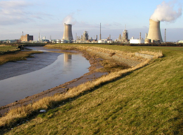
File:Hedon Clough and the BP Chemicals site at Saltend - geograph.org.uk - 145508.jpg
Hedon_Clough_and_the_BP_Chemicals_site_at_Saltend_-_geograph.org.uk_-_145508.jpg (640 × 472 pixels, file size: 100 KB, MIME type: image/jpeg)
| |
This is a file from the Wikimedia Commons. Information from its description page there is shown below.
Commons is a freely licensed media file repository. You can help. |
Summary
| Description |
English: Hedon Clough and the BP Chemicals site at Salt End, East Riding of Yorkshire, England.
This waterway used to be navigable for nearly two miles up to the town of Hedon. Although nearly two miles inland, Hedon was a port long before Hull nearby was even established! The waterway has been filled in for a lot of its length, but there are ambitious plans to re-open it one day. |
| Date | 6 March 2005 |
| Source | From geograph.org.uk |
| Author | Andy Beecroft |
| Permission ( Reusing this file) |
Creative Commons Attribution Share-alike license 2.0 |
|
Camera location |
53° 43′ 51.21″ N, 0° 14′ 7.93″ W |
This and other images at their locations on: Google Maps - Google Earth - OpenStreetMap | ( Info)53.730892;-0.235535 |
|---|
Licensing
 |
This image was taken from the Geograph project collection. See this photograph's page on the Geograph website for the photographer's contact details. The copyright on this image is owned by Andy Beecroft and is licensed for reuse under the Creative Commons Attribution-ShareAlike 2.0 license. |
| This file is licensed under the Creative Commons Attribution-Share Alike 2.0 Generic license. | ||
| Attribution: Andy Beecroft | ||
http://creativecommons.org/licenses/by-sa/2.0 CC-BY-SA-2.0 Creative Commons Attribution-Share Alike 2.0 truetrue |
![]() The categories of this image should be checked. Check them now!
The categories of this image should be checked. Check them now!
- Remove redundant categories and try to put this image in the most specific category/categories
- Remove this template
- The location categories are based on information from this geonames tool and this OpenStreetMap tool combined with a database. You can also have a look at this tool from mysociety.
- The topic category from Geograph was Creek (find similar images at Geograph)
This image was uploaded as part of the Geograph batch upload
File usage
The following pages on Schools Wikipedia link to this image (list may be incomplete):
Metadata
This file contains additional information, probably added from the digital camera or scanner used to create or digitize it. If the file has been modified from its original state, some details may not fully reflect the modified file.
| Image title | OLYMPUS DIGITAL CAMERA |
|---|---|
| Camera manufacturer | OLYMPUS OPTICAL CO.,LTD |
| Camera model | C4040Z |
| Exposure time | 1/650 sec (0.0015384615384615) |
| F-number | f/4 |
| ISO speed rating | 100 |
| Date and time of data generation | 16:30, 6 March 2005 |
| Lens focal length | 8.4 mm |
| Orientation | Normal |
| Horizontal resolution | 72 dpi |
| Vertical resolution | 72 dpi |
| Software used | OLYMPUS CAMEDIA Master |
| File change date and time | 18:25, 6 March 2005 |
| Y and C positioning | Co-sited |
| Exposure Program | Aperture priority |
| Exif version | 2.1 |
| Date and time of digitizing | 16:30, 6 March 2005 |
| Image compression mode | 1 |
| Exposure bias | 0 |
| Maximum land aperture | 1.7 APEX (f/1.8) |
| Metering mode | Pattern |
| Light source | Unknown |
| Flash | Flash did not fire |
| Colour space | sRGB |
Want to know more?
You can learn about nearly 6,000 different topics on Schools Wikipedia. SOS Childrens Villages helps more than 2 million people across 133 countries around the world. There are many ways to help with SOS Children.

