 |
This is a file from the Wikimedia Commons. Information from its description page there is shown below.
Commons is a freely licensed media file repository. You can help.
|
== Summary ==
| Description |
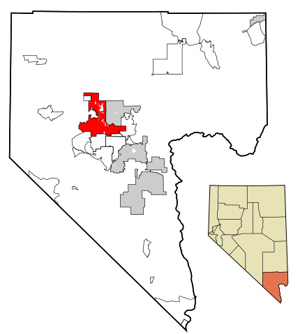
This map shows the incorporated areas in Clark County, Nevada. Las Vegas is highlighted in red. I created it in using data from the following files: Census 2000 Block Map - Clark County ( PDF) and Southern Nevada Public Lands Management Act Map ( PDF) |
| Date |
17 July 2007 |
| Source |
My own work, based on government information. Though I strove to be as accurate in the detail as possible, the information shown is not guaranteed to be completely accurate. |
| Author |
Ixnayonthetimmay |
Permission
( Reusing this file) |
Public Domain
|
== Licensing ==
| Public domainPublic domainfalsefalse |
 |
I, the copyright holder of this work, release this work into the public domain. This applies worldwide.
In some countries this may not be legally possible; if so:
I grant anyone the right to use this work for any purpose, without any conditions, unless such conditions are required by law.Public domainPublic domainfalsefalse
|
File usage
The following pages on Schools Wikipedia link to this image (list may be incomplete):
This file contains additional information, probably added from the digital camera or scanner used to create or digitize it. If the file has been modified from its original state, some details may not fully reflect the modified file.
SOS Children aims to make Wikipedia suitable for young learners. SOS Childrens Villages helps more than 2 million people across 133 countries around the world. Want to learn more? Go to http://www.soschildrensvillages.org.uk/sponsor-a-child


