 |
This is a file from the Wikimedia Commons. Information from its description page there is shown below.
Commons is a freely licensed media file repository. You can help.
|
| DescriptionSan Jose California aerial view south.jpg |
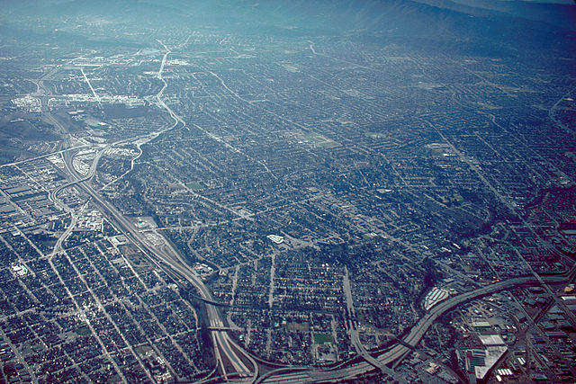
English: Aerial view of San José, California, USA. The intersection of Interstate-280 and California State Route 87 (Guadalupe Parkway) is visible at the bottom of the photograph. View is to the south.
Coordinates: 37°19′7.84″N 121°53′35.92″W / 37.3188444°N 121.8933111°W / 37.3188444; -121.8933111
|
| Date |
not specified or unknown |
| Source |
U.S. Army Corps of Engineers Digital Visual Library
Image page
Image description page
Digital Visual Library home page |
| Author |
Robert Campbell |
Permission
( Reusing this file) |
 |
Permission is granted to copy, distribute and/or modify this document under the terms of the GNU Free Documentation License, Version 1.2 or any later version published by the Free Software Foundation; with no Invariant Sections, no Front-Cover Texts, and no Back-Cover Texts. A copy of the license is included in the section entitled GNU Free Documentation License. http://www.gnu.org/copyleft/fdl.htmlGFDLGNU Free Documentation Licensetruetrue
|

|
The permission to use this work has been archived in the Wikimedia OTRS system. It is available here for users with an OTRS account. If you wish to reuse this work elsewhere, please read the instructions at COM:REUSE. If you are a Commons user and wish to confirm the permission, please leave a note at the OTRS noticeboard. Ticket link: https://secure.wikimedia.org/otrs/index.pl?Action=AgentTicketZoom&TicketID=2310743&ArticleID=2745272#2745272
|
|
File usage
The following pages on Schools Wikipedia link to this image (list may be incomplete):
This file contains additional information, probably added from the digital camera or scanner used to create or digitize it. If the file has been modified from its original state, some details may not fully reflect the modified file.


