Port Louis
Background Information
This Schools selection was originally chosen by SOS Children for schools in the developing world without internet access. It is available as a intranet download. Visit the SOS Children website at http://www.soschildren.org/
| Port Louis | |||
|---|---|---|---|
| — City — | |||
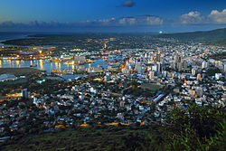
| Aerial view of Port Louis in evening | |||
|
|||
| Motto: "CONCORDIA ET PROGRESSIO" (Latin for "Harmony and progress") |
|||
|
|
|||
| Coordinates: 20°9′51.7896″S 57°30′14.7738″E Coordinates: 20°9′51.7896″S 57°30′14.7738″E | |||
| Country | |||
| Districts | Port Louis District | ||
| Town | 25 August 1966 | ||
| City | 12 December 2011 | ||
| Government | |||
| • Type | Municipality | ||
| • Lord Mayor | Aslam Adam Hossenally | ||
| • Deputy Lord Mayor | Mr. Marie Désiré Audie Paul Travailleur | ||
| Area | |||
| • Total | 46.7 km2 (18.0 sq mi) | ||
| Population (2011) | |||
| • Total | 137,608 | ||
| • Rank | 1st in Mauritius | ||
| • Density | 2,946.6/km2 (7,632/sq mi) | ||
| Time zone | MUT ( UTC+4) | ||
| Website | Municipal Council | ||
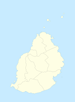
Port Louis (pɔʁlwi) is a city in Mauritius, located in the Port Louis District, the western part also lies in the Rivière Noire District. It is the capital of Mauritius and administered by the Municipal City Council of Port Louis. The city is the country's economic, cultural, political centre and most populous city. According to the census made by Statistics Mauritius in 2011, the population was at 137,608.
History
Port Louis was already in use as a harbour in 1638. In 1735, under French government, it became the administrative centre of Mauritius and a major reprovisioning halt for French ships travelling around the Cape of Good Hope. The Port is named in honour of King Louis XV. The first Governor was Count Bertrand-François Mahé de La Bourdonnais.
Economy
The economy of the city is mostly dominated by its financial centre, port facilities, tourism and the manufacturing sector which include textiles, chemicals, plastics and pharmaceuticals. Port Louis is home to the biggest port facility in the Indian Ocean region and one of Africa’s major financial centre.
Transportation
Air transportation to the city is provided by SSR International Airport. Port Louis is served by two major bus stations. Victoria Station is used by buses to and from the eastern and southern areas and the Plaines Wilhems district. Immigration Square, also known as Gare du Nord, is a terminus for buses coming from the Northern districts of Pamplemousses and Rivière du Rempart. A number of inter-city buses carry passengers to and from nearby suburbs such as Plaine Verte, Vallée-des-Prêtres and Cassis. To cope with an increase in traffic congestion, the government has proposed a Light rail transit from Curepipe to the city.
Sports
One of the most popular event is the Thoroughbred horse races held at the Champ de Mars Racecourse which is the second oldest horse race track in the world. Popular sports include football and volleyball. The Football team of Port Louis is the AS Port-Louis 2000.
Suburbs
Port Louis is divided into different regions.
|
|
Climate
Port Louis features a semi-arid climate under Köppen's climate classification. Its wettest months are from December through April where on average 100 mm (or more) of rain falls during each of these month. The months of September through November forms the dry season, though technically July, with an average of just under 60 mm of precipitation, could be considered a dry season month. The city also shows a noticeable range of average temperatures. Port Louis’ coolest temperatures are seen mid-year where average high temperatures are around 24 °C. During the height of the wet season, the city sees its highest temperatures where average high temperatures are usually around 30 °C.
| Climate data for Port Louis | |||||||||||||
|---|---|---|---|---|---|---|---|---|---|---|---|---|---|
| Month | Jan | Feb | Mar | Apr | May | Jun | Jul | Aug | Sep | Oct | Nov | Dec | Year |
| Record high °C (°F) | 35 (95) |
33 (91) |
32 (90) |
31 (88) |
29 (84) |
28 (82) |
27 (81) |
27 (81) |
28 (82) |
31 (88) |
33 (91) |
35 (95) |
35 (95) |
| Average high °C (°F) | 31.5 (88.7) |
31.4 (88.5) |
31.5 (88.7) |
30.7 (87.3) |
29.3 (84.7) |
27.6 (81.7) |
26.7 (80.1) |
26.8 (80.2) |
27.7 (81.9) |
28.8 (83.8) |
30.2 (86.4) |
31.1 (88) |
29.44 (85) |
| Average low °C (°F) | 24.1 (75.4) |
24.0 (75.2) |
23.8 (74.8) |
23.0 (73.4) |
21.5 (70.7) |
19.9 (67.8) |
19.3 (66.7) |
19.1 (66.4) |
19.4 (66.9) |
20.4 (68.7) |
21.8 (71.2) |
23.2 (73.8) |
21.63 (70.92) |
| Record low °C (°F) | 17 (63) |
18 (64) |
17 (63) |
14 (57) |
13 (55) |
11 (52) |
11 (52) |
10 (50) |
11 (52) |
13 (55) |
14 (57) |
17 (63) |
10 (50) |
| Precipitation mm (inches) | 131 (5.16) |
160 (6.3) |
83 (3.27) |
87 (3.43) |
48 (1.89) |
24 (0.94) |
18 (0.71) |
19 (0.75) |
17 (0.67) |
15 (0.59) |
24 (0.94) |
85 (3.35) |
711 (28) |
| Avg. precipitation days (≥ 1.0 mm) | 9 | 10 | 8 | 7 | 6 | 4 | 4 | 5 | 3 | 3 | 3 | 6 | 68 |
| Mean monthly sunshine hours | 248 | 226 | 217 | 240 | 248 | 210 | 217 | 217 | 240 | 279 | 270 | 279 | 2,891 |
| Source #1: World Meteorological Organization. | |||||||||||||
| Source #2: BBC Weather | |||||||||||||


